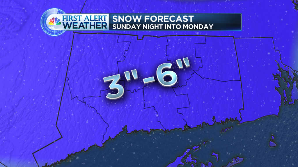
Early snowfall forecast for Sunday evening, night and Monday morning.
It’s the weekend, of COURSE we’re tracking.. more snow.
Can you FEEL the sun getting warmer? It’s trying, but winter is just holding on for dear life! Our average high “should be” around 42 degrees, we have been struggling through the 20s! Certainly on track for the coldest February EVER!
Here’s the deal with the first few days of March.
It’s the weekend, of COURSE we’re tracking.. more snow.
Can you FEEL the sun getting warmer? It’s trying, but winter is just holding on for dear life!
Here’s the deal with the first few days of March.
Saturday: Sunshine, cold. highs in the 20s. Cold, clear Saturday night.
Sunday: Increasing clouds, a wave of low pressure moves in our direction and we should see snow developing late day or in the evening.
Snow will end on Monday morning, with sunshine by afternoon.
Early call: It is looking something like a 2-4″, 3-6″ snowfall. Not major, but moderate, and messing up the Monday morning commute.
The first week of March looks stormy! We’ll see another storm move in our direction by Tuesday afternoon, this one looks to pull some warm air in here and start as snow but trend to a mix, perhaps some rain? We’ll keep you posted on that.
The bottom line: Snow piles grow even bigger, and our patience shrinks with the winter that seemingly seems never ending.
When will it warm up? I see a ‘blip’ of warmth with that midweek storm, before it gets cold again toward next weekend.
Keep your eyes on St. Patty’s Day, I see ‘some’ warmth by then (appreciable .. but short lived).
Think warm, it will happen, it’s just going to take some time to transition from this record breaking winter.