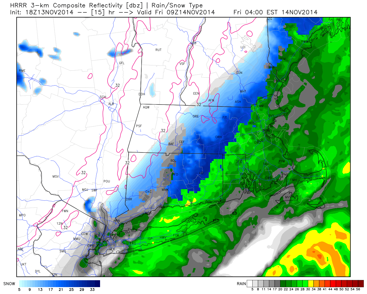
Midnight to 2AM we will see more places transition to snow. I also want to draw your attention to a burst of heavier snow in the Worcester Hills. This heavier burst will likely extend into the northeast hills over the next couple of hours.
‘Tis the season.. We knew it had to happen sometime, and with the arctic invasion across the country, we knew our days were numbered.
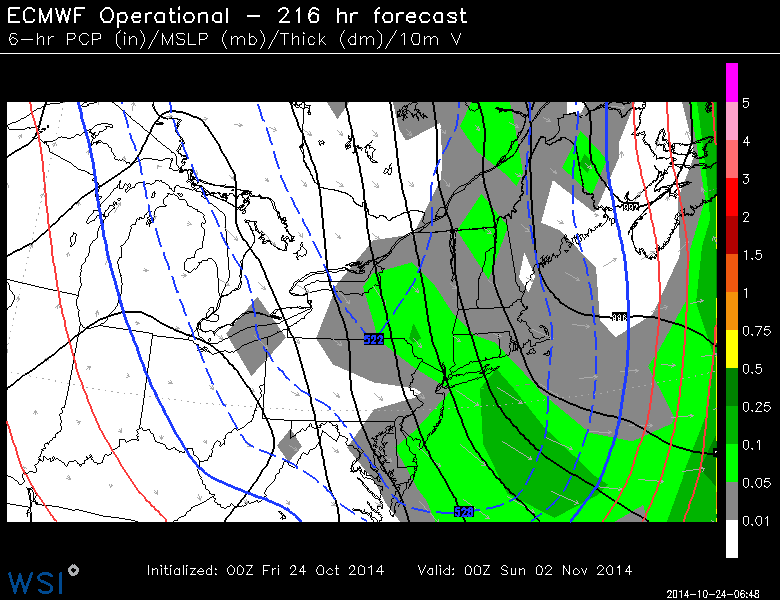
This snow potential has been in the forecast for several days now. As always, it’s always good to wait until you get closer to really fine tune the details.
This is not going to be a blockbuster storm. A disturbance moving our way is going to throw some moisture back in our direction. At the same time, colder air is building in. It’s not THE best set up for snow being how warm it has been, but we should at least see our first flakes of the season
THE BREAKDOWN:
Precip breaks out tonight between 9PM and midnight. At that point, some will start with some light snow (hills) others rain/wet snow mix. Likely rain at the shore/valley locales.

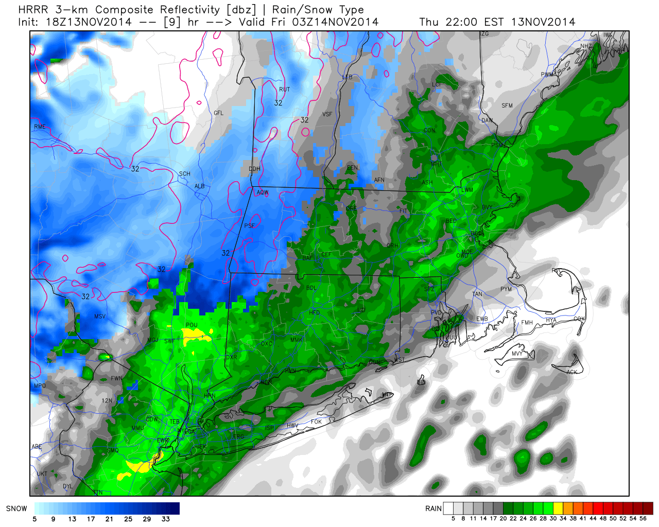
Rain starts to break out across the state.
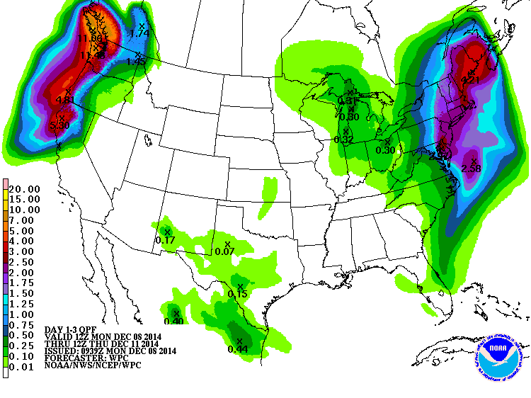
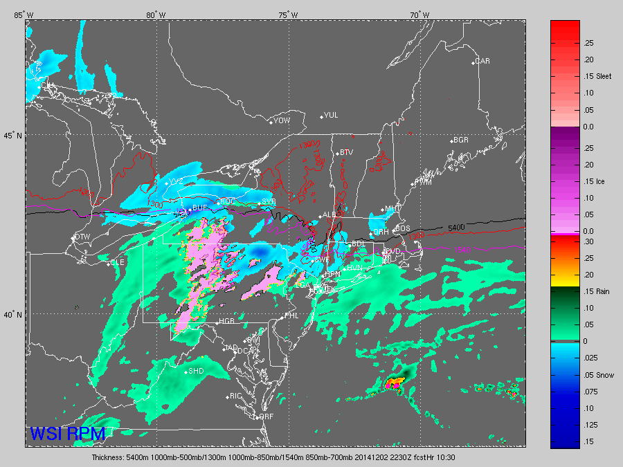
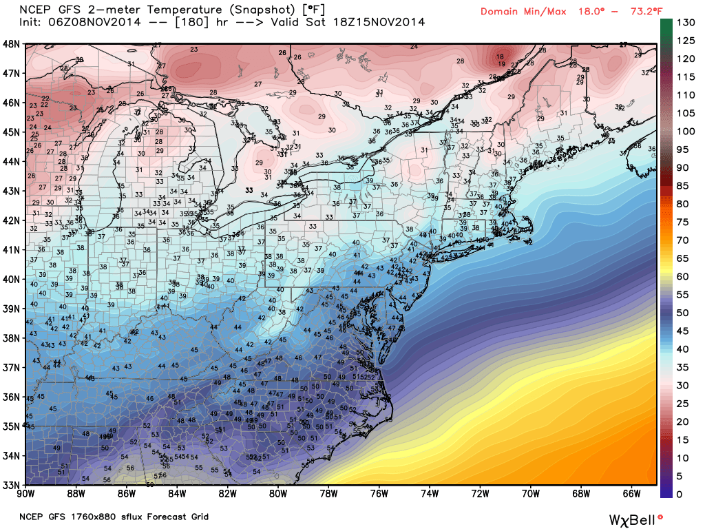
This model may be a bit overdone on the rain, but you can also see hill-towns already starting as snow or transitioning to snow fairly quickly.

Midnight to 2AM we will see more places transition to snow. I also want to draw your attention to a burst of heavier snow in the Worcester Hills. This heavier burst will likely extend into the northeast hills over the next couple of hours.

By 4 AM, the back edge of the precip will start to enter the western part of the state.
Still snowing, moderate with a burst east/northeast CT. The 395 corridor will likely go from rain to slush as you work from southern parts of the state north (quickly).
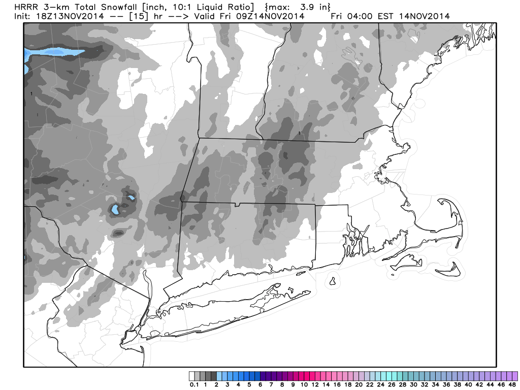
This area has the best chance at seeing 1-3″ of snow
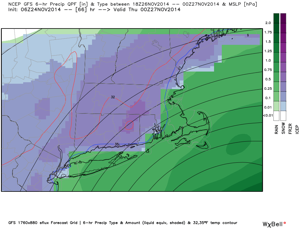
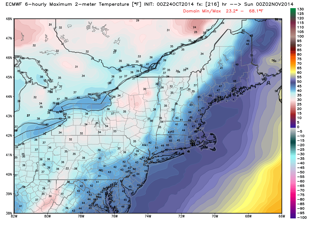
Will it accumulate?

One model depiction of how much snow to expect. See explanation above.
HOW MUCH?
–Northwest hills: can see an inch or 2. Mostly grassy areas, but also some slick spots develop. Contractors you should have the equipment ready to go as there will likely be some sidewalks and parking lots needed treatments.
Valley (along I-91): Mostly grassy accumulation but a coating up to an inch is possible. It’s possible that some side streets especially have some slick spots by the AM commute.
Shoreline: Pretty much the same as the valley, although mostly just mixed precip until the very end should keep pavement clear along I-95
Northeast Hills: I like what i see in many of the models for snow growth potential and more intense precipitation (at least for a short time before tapering off). 1-2″ are likely, with one or two towns coming in with a 3″ amount.
As you can see, this is not a blockbuster. Also, it should be tapering from west to east 4-6 AM.
The “first flakes” always cause a bit of excitement, although some towns may wake up a little underwhelmed. At least we can ease into the winter season, rather than being clobbered out of the gate, right?
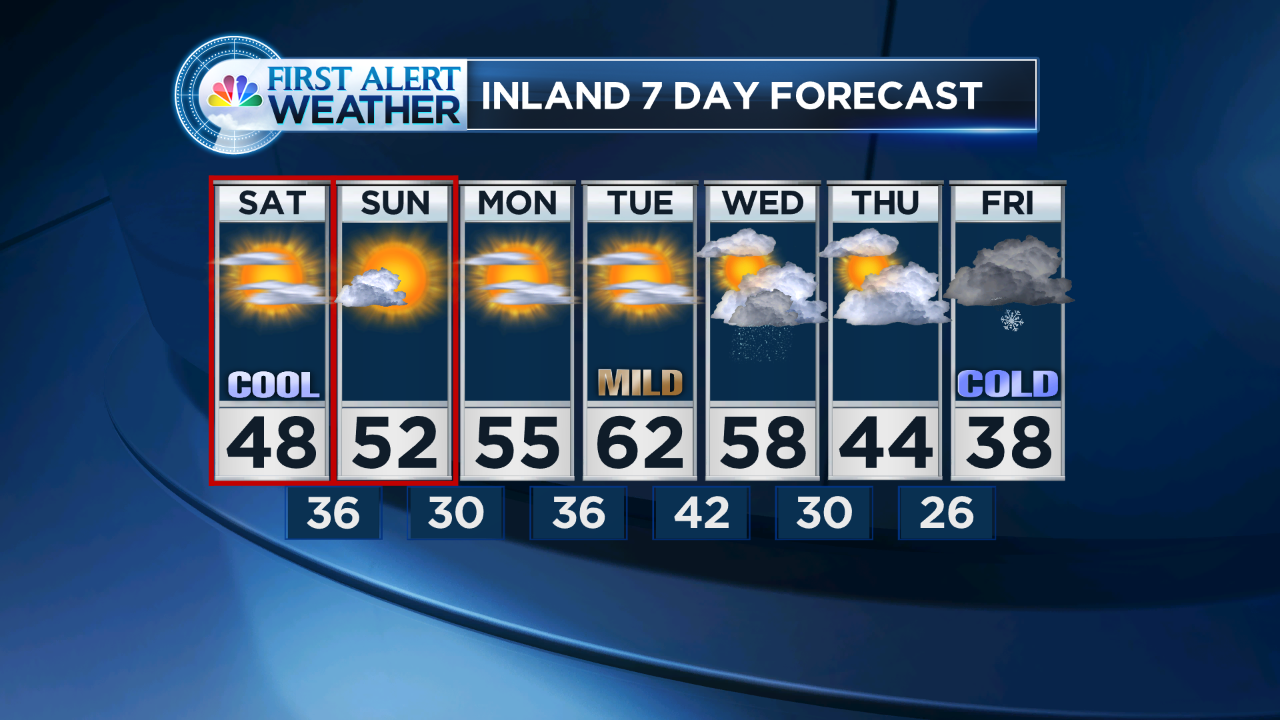
Oh, and by the way. The next big weather stories are: MORE cold for the weekend (highs in the 30s) and the next storm looks to bring some precip on Sunday night. into Monday. Still lots of questions with that storm, it looks to bring some warm air (before more cold). We’ll blog about that one later.
Please remember to follow and interact on twitter @DARRENSWEENEY or Facebook http://www.facebook.com/weatherdarrensweeney (or see the links to the right)