Author Archives: sweeneydj

Increasing confidence for a winter storm on the busiest travel day of the year!

snowmanchester

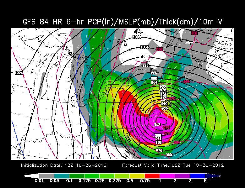
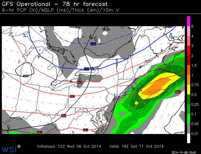
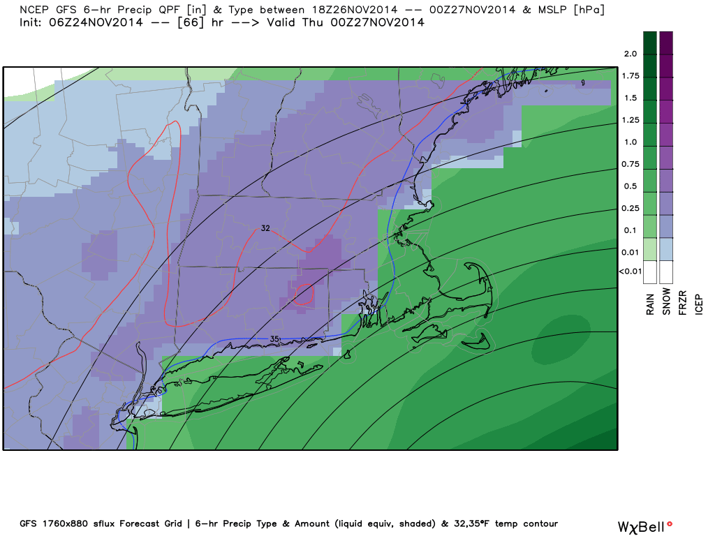
The GFS model shows a healthy swath of accumulating snow Wednesday evening.

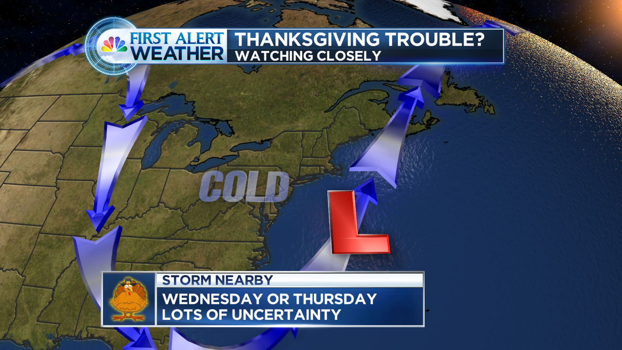
Over the weekend I began talking about a possible storm for the busiest travel day of the year. It is looking more likely that we will see ‘something’ on that day.  In fact, the National Weather Service has issued a Winter Storm Watch (click to see the text from the NWS).

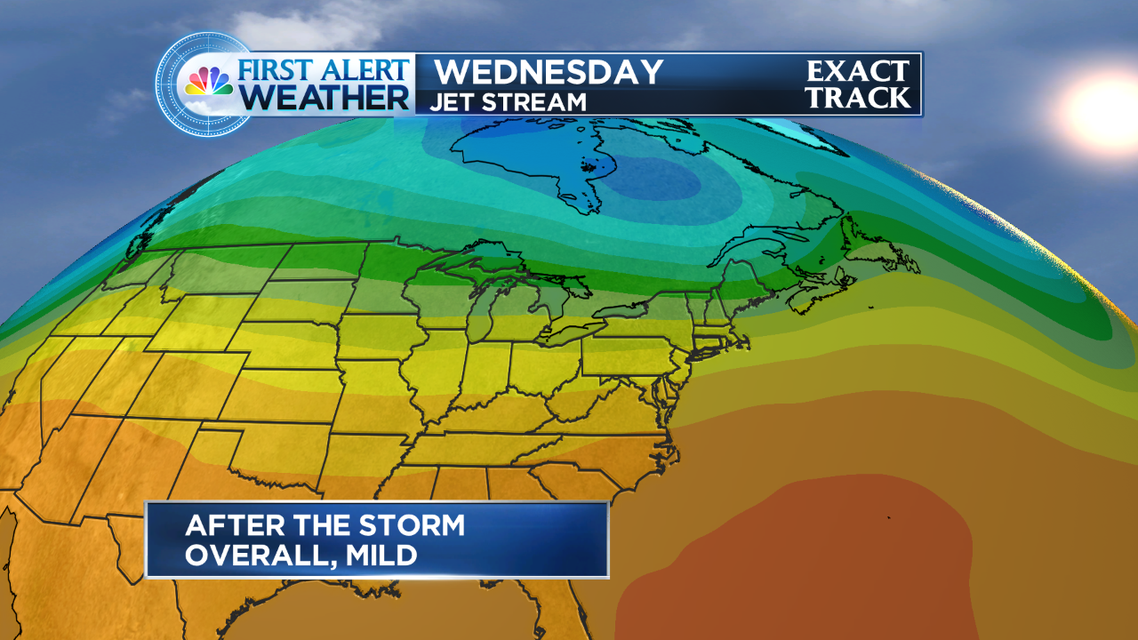
Here are my thoughts::  At this point there is still some model spread as to how close a fairly strong area of low pressure will pass by.  Some model data wants to hug the coast with the storm, which isn’t the best track for all snow.

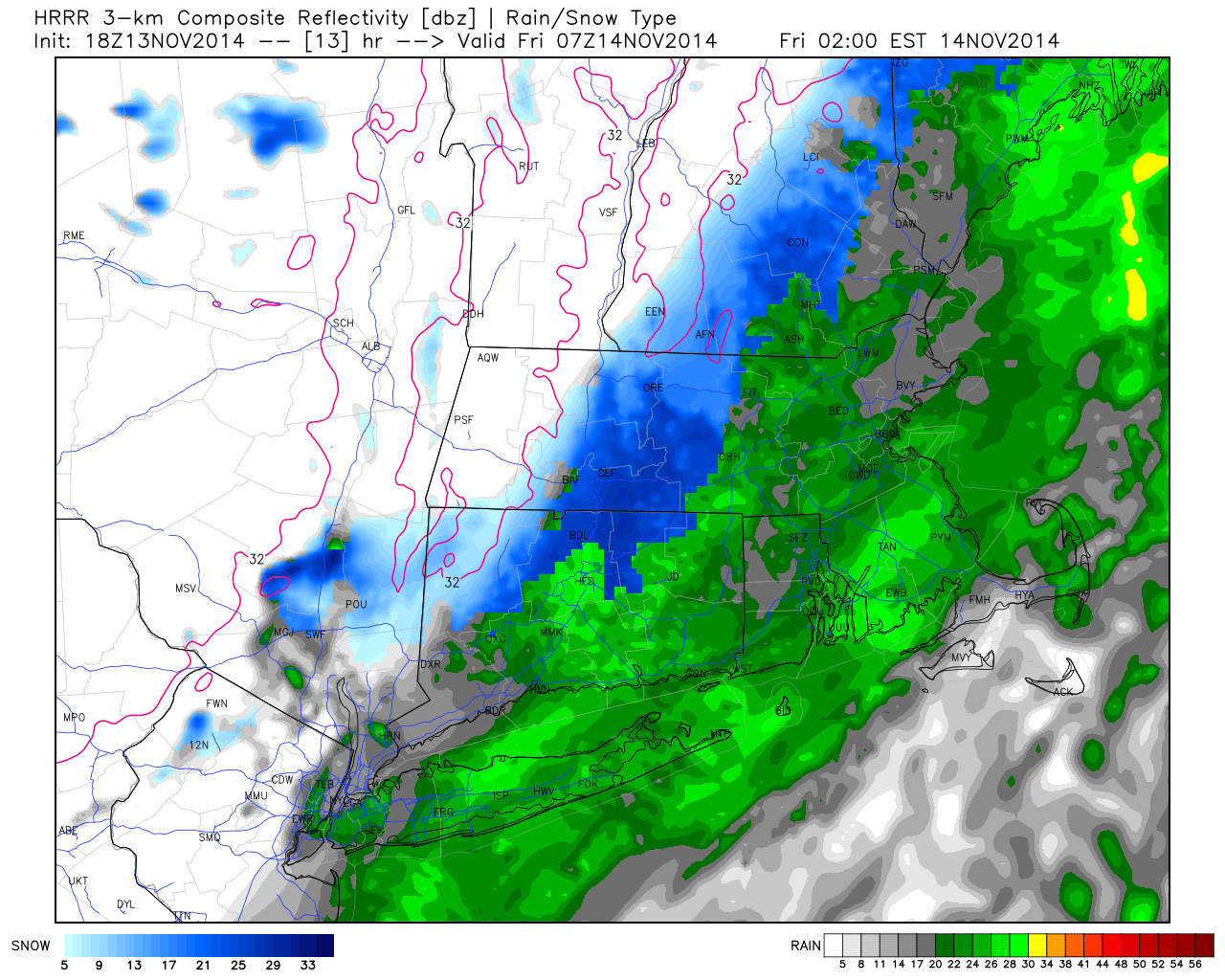
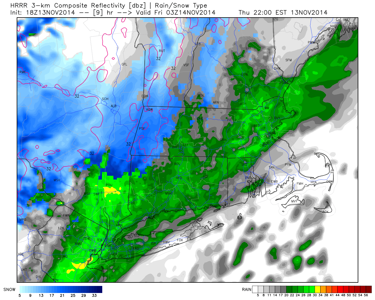
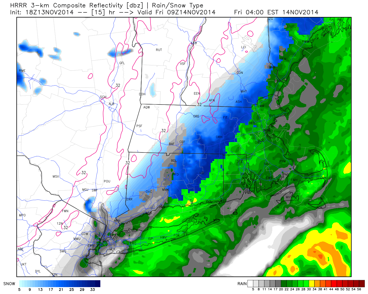
The Breakdown:  It looks like rain or a rain/snow mix will develop on Wednesday morning.   Snow will be wet to start (especially a mix with rain and sleet along the shore) so accumulating snow may take some time to get going ( (at least on roadways) because temperatures will be on the milder side at the very start.  Once the sun sets and the storm intensifies, temps will drop and the snow will begin to accumulate.   There is a chance we could see 6+ inches of snow especially in northern and n/eastern CT.  The northwest hills will also pile up probably the most snow because accumulating snow will begin sooner there.

Even if you’re not traveling on Wednesday, it tends to be one of the busiest errand days of the year getting ready for the holiday.  Also, about 14,000 of you are registered for the Manchester Road Race on Thanksgiving Morning.   The GOOD news for all of you, the storm will be pulling away by Thursday morning and snow wlll taper during the early morning hours.

How does the storm impact the Macy’s Parade ?  No matter what happens on Wednesday night, the storm will leave us with a mix of clouds and sun on Thanksgiving morning but it will be breezy, the wind could be a problem for the big balloons.

The bottom line:  If you have any travel planned Wednesday morning through Thursday morning, stay tuned to the #FirstAlertCT forecast team.  On this blog, on the web you can find both the text and video First Alert Forecast.      You can also like my my facebook page and twitter page(see the boxes to the right).  CLICK FOLLOW ON THE RIGHT TO FOLLOW THIS BLOG.. It will email you whenever new blog updates are posted.

Turkey Trouble? Some data supports a storm near Thanksgiving

Watching the data closely as a storm looks to form midweek.

Watching the data closely as a storm looks to form midweek.

Over the last couple of days some computer data has been hinting at a storm threat for the Wednesday/Thursday timeframe.

As of this morning, one computer model had a storm close by with accumulating snow into Thursday morning.  The (GFS) was farther out to sea.   As of this blog post (1130AM Saturday)  the GFS has backed closer to the coast.

Does that mean a snowstorm is a lock for Wednesday night?  Absolutely not.  A lot more has to come together, including storm intensity, track, etc.  A lot of detail to work out.

It’s worth mentioning because of the busy week of travel many have next week.  It has been a while since we had snow on Thanksgiving, but it’s not all too rare.

I will keep you posted as trends in the data begin to show something solid.  I won’t update this blog with every model run, as there will be fluctuations between now and then.   One way I forecast is by watching trends and ensembles to see how they do over a period of time. Some mets like to jump up and down with each model run.  That’s how bad information gets out.

Stay tuned…

First flakes of the season on the way (It had to happen sometime, right?)

Midnight to 2AM we will see more places transition to snow.  I also want to draw your attention to a burst of heavier snow in the Worcester Hills.  This heavier burst will likely extend into the northeast hills over the next couple of hours.

Midnight to 2AM we will see more places transition to snow. I also want to draw your attention to a burst of heavier snow in the Worcester Hills. This heavier burst will likely extend into the northeast hills over the next couple of hours.

‘Tis the season..  We knew it had to happen sometime, and with the arctic invasion across the country, we knew our days were numbered.

This snow potential has been in the forecast for several days now.  As always, it’s always good to wait until you get closer to really fine tune the details.

This is not going to be a blockbuster storm.  A disturbance moving our way is going to throw some moisture back in our direction.  At the same time, colder air is building in.  It’s not THE best set up for snow being how warm it has been, but we should at least see our first flakes of the season

THE BREAKDOWN:

Precip breaks out tonight between 9PM and midnight.  At that point, some will start with some light snow (hills) others rain/wet snow mix.  Likely rain at the shore/valley locales.

Rain starts to break out across the state. This model may be a bit overdone on the rain, but you can also see hill-towns already starting as snow or transitioning to snow fairly quickly.

Rain starts to break out across the state.
This model may be a bit overdone on the rain, but you can also see hill-towns already starting as snow or transitioning to snow fairly quickly.

Midnight to 2AM we will see more places transition to snow.  I also want to draw your attention to a burst of heavier snow in the Worcester Hills.  This heavier burst will likely extend into the northeast hills over the next couple of hours.

Midnight to 2AM we will see more places transition to snow. I also want to draw your attention to a burst of heavier snow in the Worcester Hills. This heavier burst will likely extend into the northeast hills over the next couple of hours.

By 4 AM, the back edge of the precip will start to enter the western part of the state. Still snowing, moderate with a burst east/northeast CT.  The 395 corridor will likely go from rain to slush as you work from southern parts of the state north (quickly). This area has the best chance at seeing 1-3" of snow

By 4 AM, the back edge of the precip will start to enter the western part of the state.
Still snowing, moderate with a burst east/northeast CT. The 395 corridor will likely go from rain to slush as you work from southern parts of the state north (quickly).
This area has the best chance at seeing 1-3″ of snow

Will it accumulate?

How much snow can we expect?

One model depiction of how much snow to expect. See explanation above.

HOW MUCH? 

Northwest hills: can see an inch or 2.  Mostly grassy areas, but also some slick spots develop. Contractors you should have the equipment ready to go as there will likely be some sidewalks and parking lots needed treatments.

Valley (along I-91): Mostly grassy accumulation but a coating up to an inch is possible.  It’s possible that some side streets especially have some slick spots by the AM commute.

Shoreline: Pretty much the same as the valley, although mostly just mixed precip until the very end should keep pavement clear along I-95

Northeast Hills:  I like what i see in many of the models for snow growth potential and more intense precipitation (at least for a short time before tapering off).  1-2″ are likely, with one or two towns coming in with a 3″ amount.

As you can see, this is not a blockbuster.  Also, it should be tapering from west to east 4-6 AM.

The “first flakes” always cause a bit of excitement, although some towns may wake up a little underwhelmed.  At least we can ease into the winter season, rather than being clobbered out of the gate, right?

Oh, and by the way.  The next big weather stories are:  MORE cold for the weekend (highs in the 30s) and the next storm looks to bring some precip on Sunday night. into Monday.  Still lots of questions with that storm, it looks to bring some warm air (before more cold).  We’ll blog about that one later.

Please remember to follow and interact on twitter @DARRENSWEENEY or Facebook http://www.facebook.com/weatherdarrensweeney (or see the links to the right)

Enjoy the warmth now because arctic cold is coming

The coldest air of the season will make headlines over the next several days.

For us, we have a few days to enjoy the warmer weather, before the arctic cold makes its way south.

WVIT Forecast 7 Day 2015

The 7-day forecast above shows temps nearing 60 by Tuesday and Wednesday.  Take a look at the end of the week. We almost cut that 62 degree temperature in half by Friday.

highssaturday

Take a look at the temps above, this is one computer model showing highs next Saturday in the 30s.

If you want to see a jet stream animation of what’s to come, click here

Now, the big question will be, will there be any moisture to meet up with the cold.  At this point there looks to be some sliding by to our south on Friday.  Beyond that, longer range models show a cold and fairly storm pattern pre-Thanksgiving.  Stay tuned!

Hurricane Sandy: Two Years Ago Today

This was one computer model (GFS) showing hurricane Sandy.

This was one computer model (GFS) showing hurricane Sandy.


If you’re not on twitter but would like to view what everyone is talking about today, check out my Storify timeline of what people are saying.  The big talk today is about Hurricane Sandy, which pummeled the east coast two years ago today.

If you’re not familiar with Storify, it is a way to collect media (on social media) and put it into one ‘story’ at a glance.  It’s a great way to see and read what people are talking about.  It’s a way to put all of those #’s to use.   Below is a collection of #HurricaneSandy #Sandy #HurricaneSandyAnniversary

Hurricane Sandy: What images people are sharing today

Fotobabble:  Hurricane Sandy and the “GFS”

A mild end to October, but a cold blast to start November?

The stubborn storm that plagued our weather this week, finally moves away.  We’re lucky this storm did not happen in December or later.  The position of the storm and the slow moving nature of it could have meant a lot of shoveling for us.

Beyond the storm, it’s looking mild for the end of October.  Take a look at the Jetstream map for the week ahead.  The yellow and orange colors indicate warming in the atmosphere.  Temps will generally be in the upper 60s to perhaps 70 degrees!

WVIT Jet Stream

Enjoy those mild temps, because more and more data is supporting a blast of cold, wind and even some rain as we start November (which is next weekend).

The weather map below shows projected highs for next weekend, perhaps not getting out of the 40s with a bunch of wind!  it looks like the coldest air of the season timed with the start of November.

nextweekendblastofcold

next weekend cold blast

In the image above, keep an eye on the solid blue line.  That is the ‘540 thickness’ line.  That line generally indicates the column of air is below freezing and can be a first indicater of the rain/snow line.  That being said, that does not mean any precipitation showing up north of this lines means it will be frozen. There are several other factors that play into the temperature of the column of air above.  It is a good thing to look for on weather maps if you’re looking to eyeball for cold air.  Obviously that ‘540 line’ is almost to the Mid-Atlantic by next weekend.  Besides the coming cold, it could mean some rain for the Halloween holiday.

That means brrr for us!  Overall, looking a long range models into November, the end trend is for more mild than cold.  A little something for everyone as we transition into November.

Get the jackets, sweaters and umbrellas ready to go…

Big weather changes are on the way.  It has been feeling fantastic lately.  The high temperature Friday at Bradley Airport was 74 degrees.  We’ll likely get close to 70 on today.

Beyond today, 2 big changes to discuss.

First, a big temperature change for Sunday.  Take a look at the difference this next cold front is going to make.  It takes us from near 70 to struggling into the 50s by Sunday afternoon.  Some towns do not get out of the 40s!  Also, factor in a decent wind gusting over 20MPH at times and that means we’ll have an even colder wind chill.

NE Close Highs Today NE Close Highs Tomorrow

After the chill on Sunday, the big weather story turns to a stubborn area of low pressure which sets up shop across the northeast.  Our weather goes down hill on Tuesday with an increase in clouds and late showers.  We then can expect periods of rain and wind. Some of the rain could be heavy right into Friday.

WVIT Forecast Animation 2

Get the jackets and umbrellas ready for a changeable week ahead.

Columbus Day Weekend is coming: Foliage, wine tours, weddings, a Marathon and rain?

This photo is courtesy of http://www.foliagenetwork.com and shows the foliage as of October 6th. For a more updated report, please click here: http://bit.ly/1vNmcwp              

I wish I had a dollar for every email, Tweet or Facebook post I have received asking about this weekend.  There is a LOT going on.

This is a huge weekend for the state’s economy.  People will be off from school and looking for things to do.  It’s a huge wedding weekend (to take advantage of the fall foliage) and of course thousands of runners have been training for the Hartford Marathon.  That’s just a slice of what’s happening.

What can you expect?  As the title above says, rain will be an issue for one slice of the weekend.  For Marathon runners and spectators it looks to fall during Saturday morning.  This is a big weekend for the area wineries as well. The good thing about the wineries is that they can be enjoyed on a sunny or rainy day.

The computer data has been pretty consistent in bringing an area of low pressure by to our south Friday night into Saturday morning.

gfs_op_apcp_f78_ne ecmwf_apcp_f78_ne

Forecast details: The two models above (The American Model – GFS (Left), The European Model – ECMWF (Right), show the 18z (early afternoon).  When it comes to the morning, both show a decent amount of rain.  Both show improvements for the second half of the day, but if you have plans in eastern MA or the Cape, expect the tapering of rain to be slow and linger for a good part of the afternoon.  It’s worth noting that the GFS model has the rain exiting a little more quickly.  There is support for this as well from the “ensemble” data, which is data that supports the models above.

The rest of the weekend looks OK.  However, another system will approach from the west and we could see showers by the second half of Columbus Day.

The weekend isn’t perfect, but if I had to choose THE best day, Sunday would be the day. Sunshine with temperatures in the 60s.  Enjoy the long holiday weekend!

Mother Nature Finds The “Autumn Switch” Just In Time For October

gfs_t2max_boston_45

Sunday’s high temperature was a record-breaking 87 degrees at Windsor Locks.  It was a phenomenal final weekend of September.

Right on cue, mother nature has found the switch to Autumn.

Over the next several days you will notice temps closer to the 70 degree mark.  Also, you’re noticing a lot of clouds and little sun.  We can thank an on-shore flow from the east for that.  There will be some much-needed shower activity as we head into the middle of the week.

A strong cold front heads our way for the weekend.  Saturday features wind and rain.  The timing on the wind and rain is still questionable. Could we salvage the a portion of the afternoon?  It’s possible.  The sun returns for Sunday (a decent breeze, too).

The picture above is a high temperature forecast from one computer model for Sunday afternoon.  Remember that strong cold front I talked about in the paragraph above? Yes, last Sunday it was shorts and t-shirt weather.  This Sunday, temps struggle out of the 50’s.  Get the apple cider ready!  Welcome to fall.

No rain until October.. except for one bump in the road…

Good morning!
The first morning of fall. I don’t like the summer to end (it’s my favorite season) but I like fall as well.

Yesterday I blogged about an exceptional 7-day forecast with sun sun sun and more sun. If you watched on the air I also talked a little about some tropical moisture we would have to watch just to our south.

10710642_727093820698305_777167955101223351_n

Computer data continues to show rain on our doorstep by Thursday. It’s still going to be a very close call.

High pressure looks expansive and impressive. It’s too soon to know if the moisture will make it here or not.

Right now, it looks like clouds increase on Wednesday night. By Thursday morning we could have a period of rain lurking just to our south.

For a neat look at how all of this evolves in movie form, click here: https://www.facebook.com/video.php?v=727102790697408&set=vb.147485551992471&type=2&theater

No matter what happens with this, it looks like the weekend still looks GREAT! Warming temps, too.

It we do not see any rain on Thursday morning, we will likely stay dry until October. Pretty incredible dry stretch.

Enjoy the sunshine until the Thursday clouds.