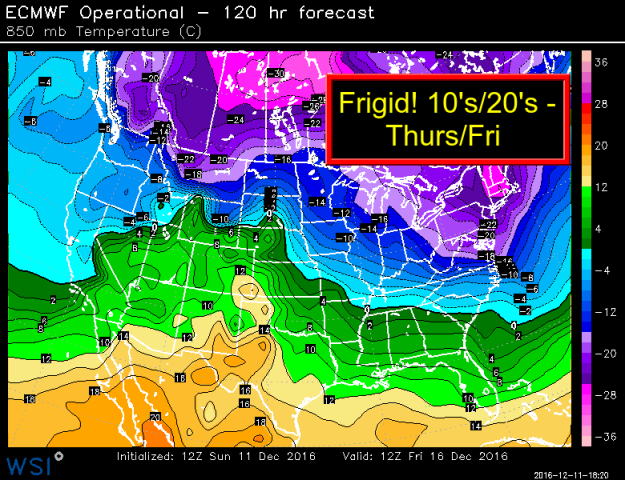
THIS IS A MAP OF 850 MB HIGHS FOR FRIDAY MORNING. 850’S GIVE METEOROLOGISTS A GOOD FIRST GLANCE AT WHAT SURFACE TEMPS CAN BE LIKE.
Get ready for “dead of winter cold” moving in this week.
I have posted an 850 MB height chart for Friday. -20 or lower heights is VERY impressive for this time of year. Remember last December? We had temps in the 60s to near 70 nearing Christmas.
This blast of cold will be short-lived, though. We’ll see highs struggle into the 20s both Thursday and Friday. Wind chill values will likely be in the single digits. That is COLD for this time of year (Winter officially has not started yet).
Another storm?
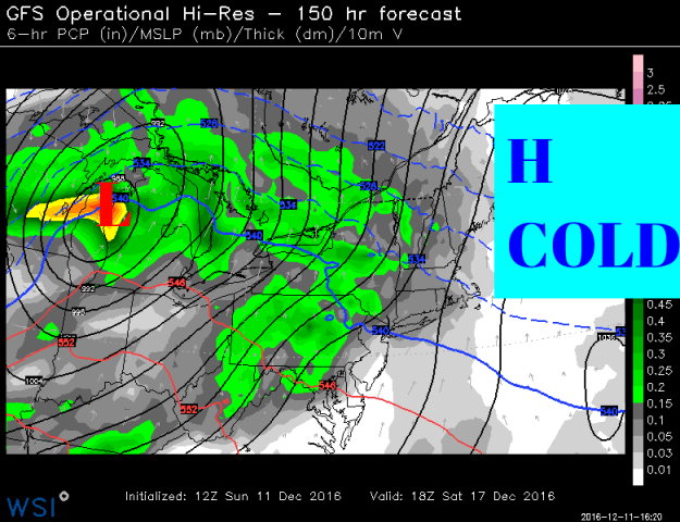
Also, next weekend is the weekend before the Christmas holiday. We’ll be tracking another storm. I have posted the GFS and Euro computer models. They have been consistent in showing a storm track to our north. That means we’ll have very cold air in place. The storm track to our north will pull in warmer air from the south. That means another round of snow over to a wintry mix scenario during the day on Saturday.
It’s way too early to speculate on amounts of specific impacts.


Warming trend for Christmas
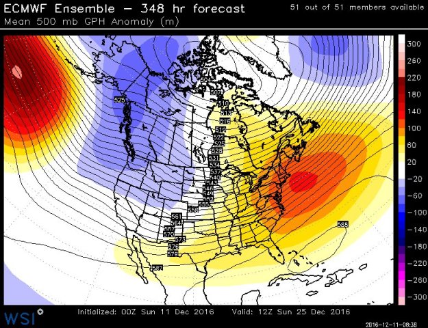
If you’re dreaming of a white Christmas the pattern shift for the second half of the month does not look good for snow. A pattern flip to colder in the west warmer in the east is looking likely. Take a look at the model map below. While I cannot commit to another 69- degree high for Christmas Eve like last year, but it is looking milder than normal as the holiday approaches.
