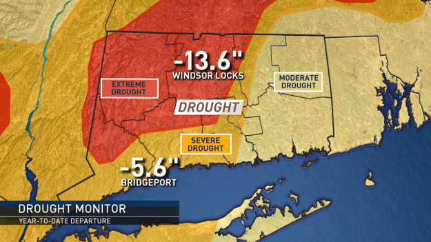
The latest drought monitor update (updated every Tuesday). This map will likely be somewhat improved for next week after this week’s soaking.
A very warm and very dry pattern this summer has continued into fall. This has not helped our drought situation across the state.
The map above outlines just how severe/extreme the drought has become. This drought monitor takes rainfall deficit and also includes factors like length of time between a soaking rain and a more long-term impact of a continuing deficit.
Over the next few days, we have a good chance of seeing at least a moderate soaking across the state. The soaking rain looks to come in two waves. Tuesday into Wednesday and then later Wednesday into Thursday.
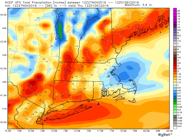
Following this area of rain, the weather pattern looks to go back to seasonably cool and dry weather into the weekend. For now, big cold and snow chances are on hold.
