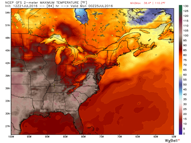
This is the GFS late Sunday showing the widespread heat across the country
If you are a fan of summer heat, the pattern over the next week or so supports 90+ degree temperatures for a good part of the country (and here in the northeast).
While some of our air may be tempered a bit (at times) from ‘some’ cooling from the north (low 90’s opposed to mid or upper 90’s) the pattern looks to lock in and not let go for some time.
Starting Friday, we’ll likely begin a string of 90+ degree days.
The image below depicts one example (Tuesday) where temps could soar into the middle and upper 90’s. At times (especially on Sunday) the shoreline will also share in the heat with a wind that will come from land (opposed to a cooling sea breeze).
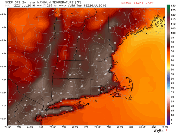
The GFS on Tuesday afternoon
“It’s not the heat.. it’s the humidity”
We hear this phrase often times during the summer months. This week, it really is going to be about the humidity making all of the difference. The image below depicts a rising dew point (the measure of the amount of moisture in the air) by Monday into Tuesday. Anything over 60 you start to feel. 65+ and it’s downright humid. Close to 70 and it’s tropical. Take a look at Monday. It’s going to feel like Key West in Connecticut.
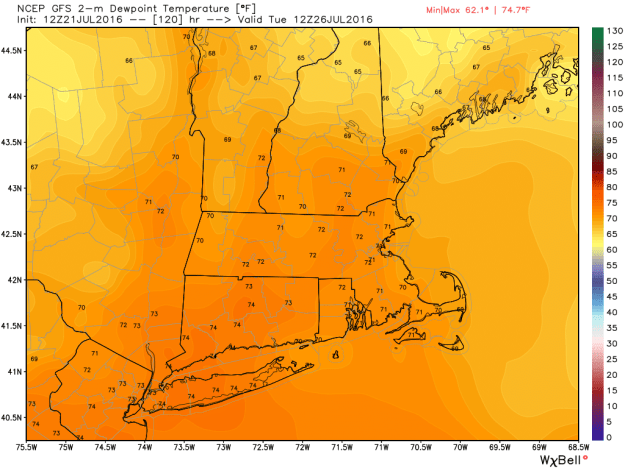
The GFS by late Monday into Tuesday showing tropical air over the Northeast.
Well into next week it looks like we’re stuck in the dog days of summer. This is climatologically speaking the warmest part of the summer season. Summer fans, soak it in.
