Snow fans have been clamoring for snow! We hear you on Facebook, Twitter and email. Those that are not fans of the real cold are counting the days to spring.
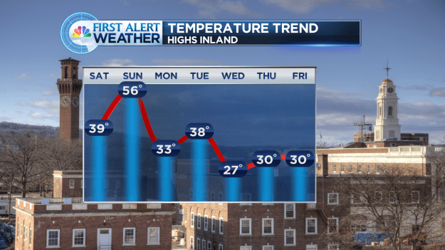
Yes, snow fans, the pattern is looking more favorable (as favorable as it can get with a strong el nino). As you can see from the image above we’ll have more cold air in place as we head into the new week.
THE FIRST SYSTEM…
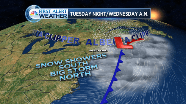
The first system we deal with is an Alberta Clipper. A vigorous area of low pressure moving through the Northeast. The problem for southern New England is that it is too far north to be a snow producer for us. The weak storm will develop into a rather strong storm to our north and east and act as a blocking mechanism for a good portion of next week. In other words, it switches up the pattern a bit unlike the last few weeks.

An Alberta Clipper goes by to our north, but too far north for a big burst of snow here. Best chance of a snowstorm from this is in Maine.

The European model (ECMWF) as of Saturday 00z. A LOT can change before next week, but we’re giving you a “First Alert” heads up on the week ahead.
ANOTHER STORM THREAT?
A southern storm will get going but model data is very split on weather it stays south or gets picked up by the jet and becomes a coastal storm threat by Friday/Saturday (see above)
Of course, we will keep you posted as new data comes in. Follow me on Twitter and Facebook for the latest details.