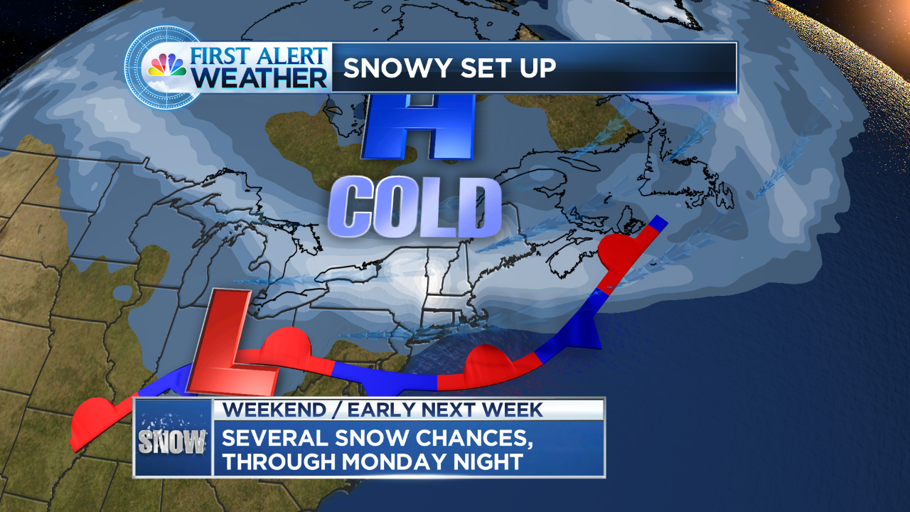
A front settling to our south will act as the focus point for several rounds of snow
This set up is not the norm. The best I can compare this to is when a front stalls during the summer and we get a couple of days of on and off rain, some heavier bouts, some lighter.
Here’s the breakdown:
Today: A few periods of light snow or flurries (especially mid to late morning). Coating, inch? possible.
Tonight/Sunday: Same deal, inch or two likely, some town northern CT pick up 3″.
Sunday night/Monday: A more impressive batch of moisture moves in, several inches of snow is likely. Right now, it appears the heaviest band will settle north of here (foot plus amounts) but it’s close by, Western Mass.
Still, light to moderate snow is possible for much of the day, which could mean another day of interrupted school and travel. There could be ice mixing in at the shore as some warmer air tries to move in.
Several inches falling through the day (could top 6″ especially northern CT) doesn’t mean a big blockbuster storm, but we’re starting to ‘inch’ our way to roof concerns, even bigger parking problems in the cities and towns with massive snow piles.
Keep in mind, we’re going to have to keep a running tally.. if we get an inch saturday, couple Sunday and 6 ish Monday, add it all up and it’s impressive nonetheless (see map).
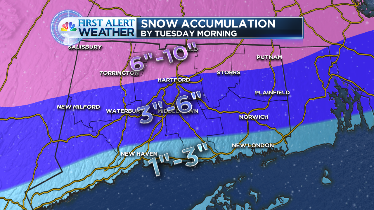
This is total snowfall after several rounds of snow, the heaviest coming late Sunday night into Monday
