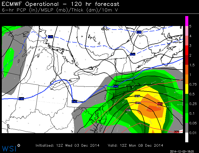
Storm threat #1 to watch for
Quick Saturday AM Update: Next week is still looking active, however, at this point, it looks like mostly a rain storm for us, starting perhaps as a wintry mix Monday night and rain and wind on Tuesday. Will keep you posted of any changes working on in.
If you want to see an animation of the storm, click here:
Stay with my blog for updates as new information comes in this weekend.
previous discussion__________________________________________________________
Forecasting: It means to look ahead. That’s what we do. Of course, since weather is not an exact science, things change, but we can do our best to keep you posted when we see “signals” of storminess ahead.
We’ve been seeing the hint of “something” in the form of an area of low pressure anytime from late Sunday into Monday night. It’s not the best set up for wintry precipitation here (although, model data has trended a little colder compared to yesterday). It bares watching, because it’s slow moving. It could bring a prolonged period of wind and rain.
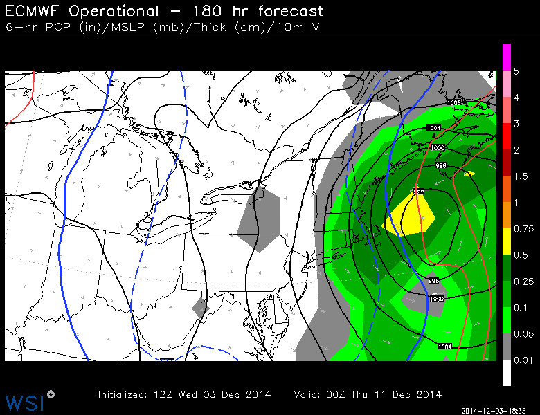
For Wednesday
Whatever happens with the Sunday/Monday system, we’ll have to watch for signs of another coastal low forming after that storm departs. This one (as of right now, and this will change) Looks colder, and favors more wintry precipitation.
As things change and evolve I’ll keep you updated here. Also, more frequently on TWITTER and FACEBOOK
