Tuesday night: Just as the cold starts to settle in, warmer air is going to make a move at us. As that warmer air moves up and over the colder air at the surface we’ll see a wintry mix break out across the state. At of this typing the warm air intrusion is pretty significant, but I can’t ignore the fact the cold is pretty impressive, too. A light mix of snow and sleet and even some freezing rain is possible, but not going to be a widespread deal. Many places won’t see any accumulation, a coating is possible though.
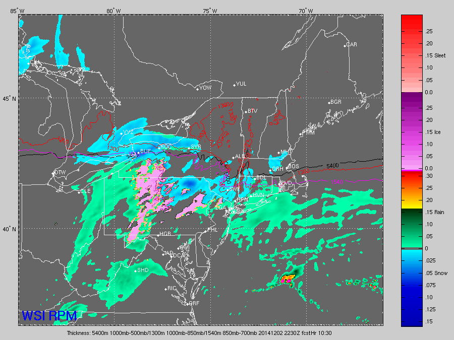
The above image shows snow and or a wintry mix breaking out across the state during the early evening. Rain will likely fall along the shore. This will go for a few hours with light snow and or mixed precipitation inland and a fairly quick change to rain along the coast. Eventually, that change to rain and or some drizzle will work inland toward morning. The biggest issues of slick roads will be north and west of Hartford.
Wednesday AM: The warm air will be overtaking the state, rising through the 30s/40s inland and 50 or so along the shore.
Wednesday: Remember how I told you the warm air will win out? We’re eventually back to milder air by Wednesday afternoon.
The rest of the week: looks seasonable with temps in the lower to middle 40s.
\We’ll stop the roller coaster ride from warm to cold to warm… with a return to seasonable temps toward the end of the week.
