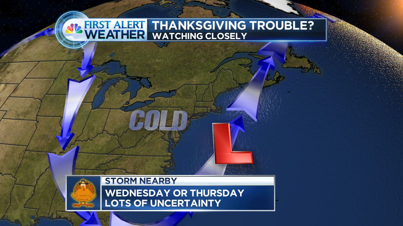
Watching the data closely as a storm looks to form midweek.
Over the last couple of days some computer data has been hinting at a storm threat for the Wednesday/Thursday timeframe.
As of this morning, one computer model had a storm close by with accumulating snow into Thursday morning. The (GFS) was farther out to sea. As of this blog post (1130AM Saturday) the GFS has backed closer to the coast.
Does that mean a snowstorm is a lock for Wednesday night? Absolutely not. A lot more has to come together, including storm intensity, track, etc. A lot of detail to work out.
It’s worth mentioning because of the busy week of travel many have next week. It has been a while since we had snow on Thanksgiving, but it’s not all too rare.
I will keep you posted as trends in the data begin to show something solid. I won’t update this blog with every model run, as there will be fluctuations between now and then. One way I forecast is by watching trends and ensembles to see how they do over a period of time. Some mets like to jump up and down with each model run. That’s how bad information gets out.
Stay tuned…
