The stubborn storm that plagued our weather this week, finally moves away. We’re lucky this storm did not happen in December or later. The position of the storm and the slow moving nature of it could have meant a lot of shoveling for us.
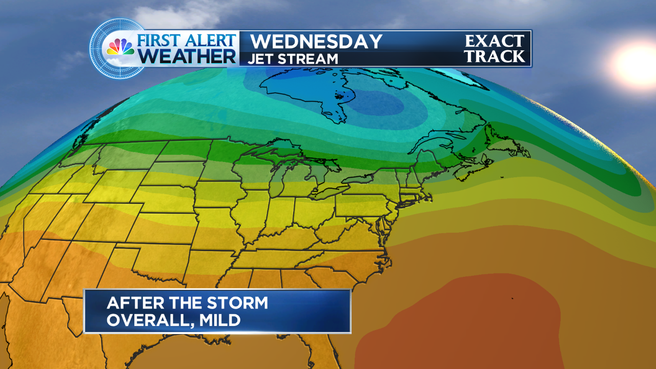
Beyond the storm, it’s looking mild for the end of October. Take a look at the Jetstream map for the week ahead. The yellow and orange colors indicate warming in the atmosphere. Temps will generally be in the upper 60s to perhaps 70 degrees!
Enjoy those mild temps, because more and more data is supporting a blast of cold, wind and even some rain as we start November (which is next weekend).
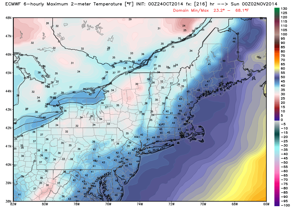
The weather map below shows projected highs for next weekend, perhaps not getting out of the 40s with a bunch of wind! it looks like the coldest air of the season timed with the start of November.
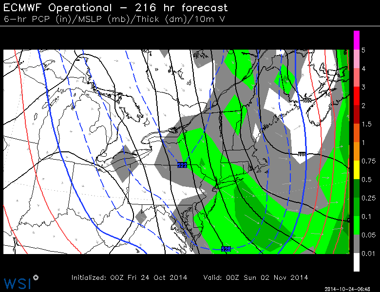
In the image above, keep an eye on the solid blue line. That is the ‘540 thickness’ line. That line generally indicates the column of air is below freezing and can be a first indicater of the rain/snow line. That being said, that does not mean any precipitation showing up north of this lines means it will be frozen. There are several other factors that play into the temperature of the column of air above. It is a good thing to look for on weather maps if you’re looking to eyeball for cold air. Obviously that ‘540 line’ is almost to the Mid-Atlantic by next weekend. Besides the coming cold, it could mean some rain for the Halloween holiday.
That means brrr for us! Overall, looking a long range models into November, the end trend is for more mild than cold. A little something for everyone as we transition into November.
